Gallery
Research cruise images
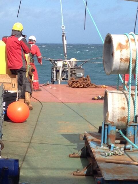
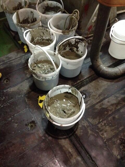
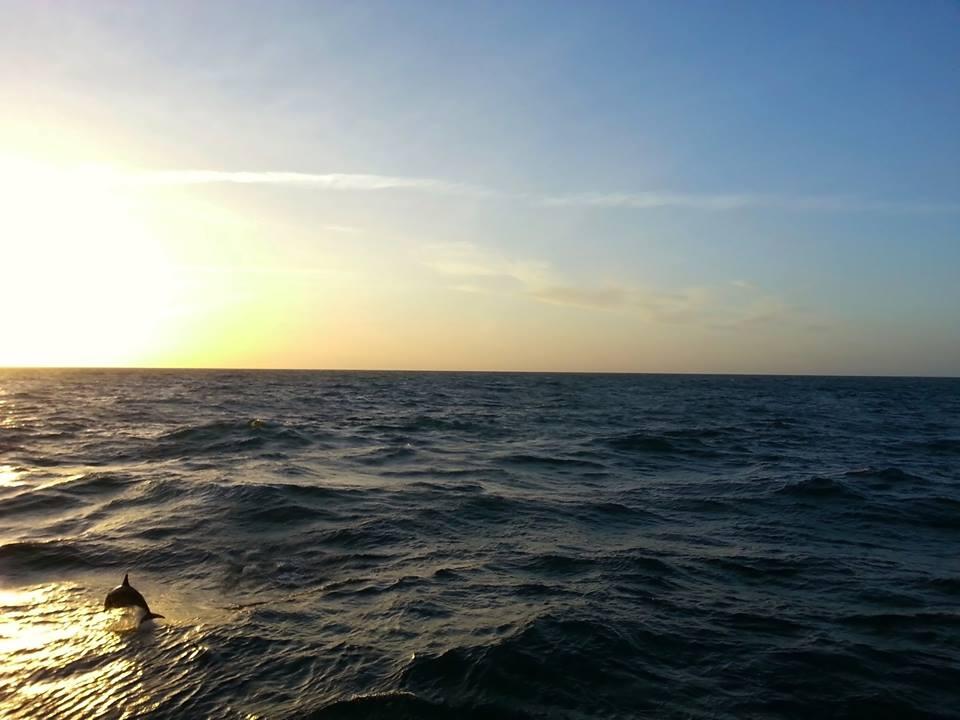
Images taken in preparation for resaerch cruises and on board RRS Discovery during the research cruises.


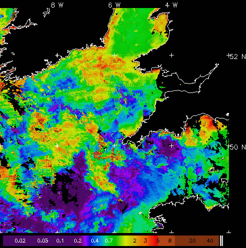
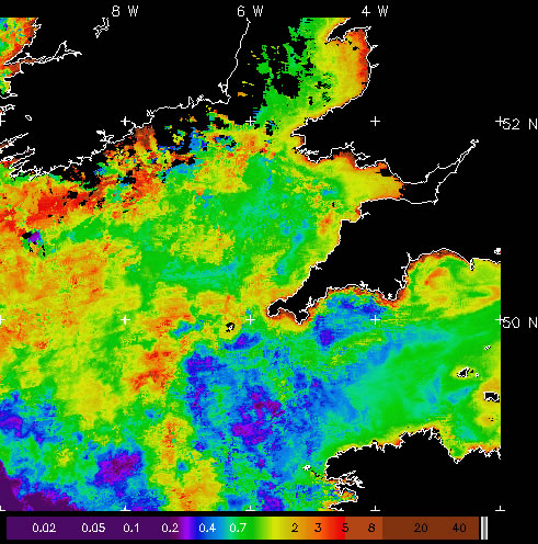
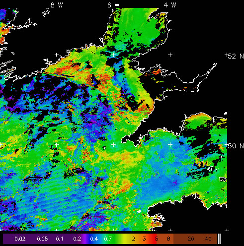
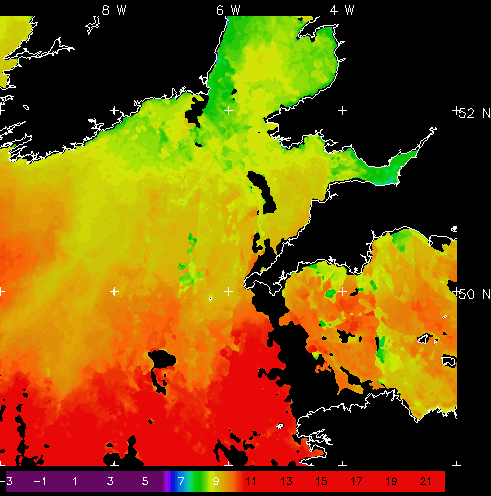
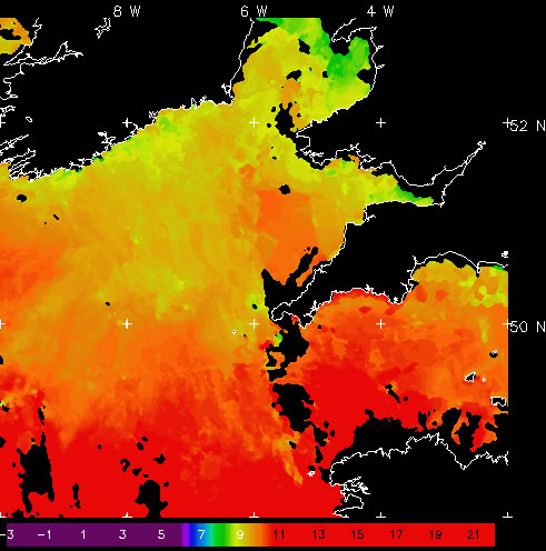
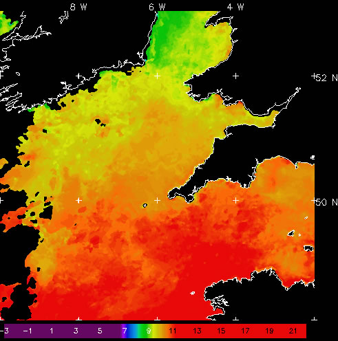
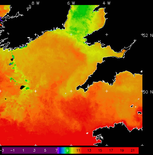
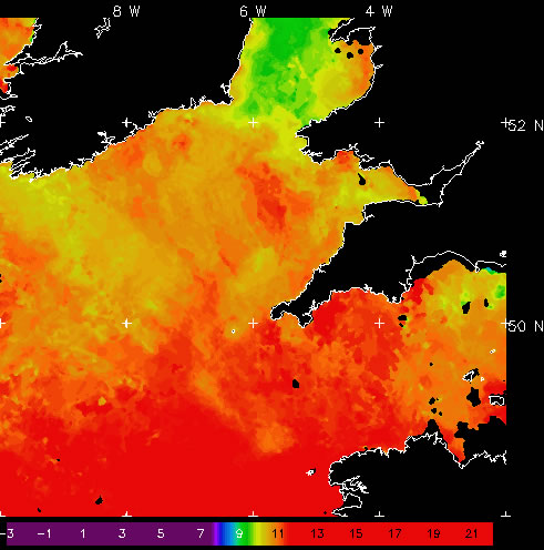
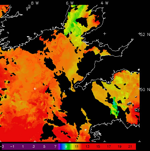
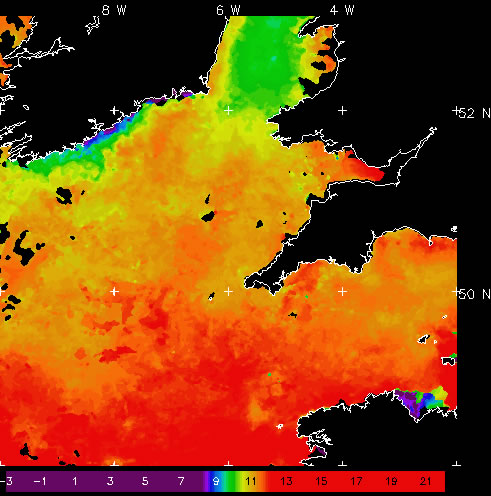
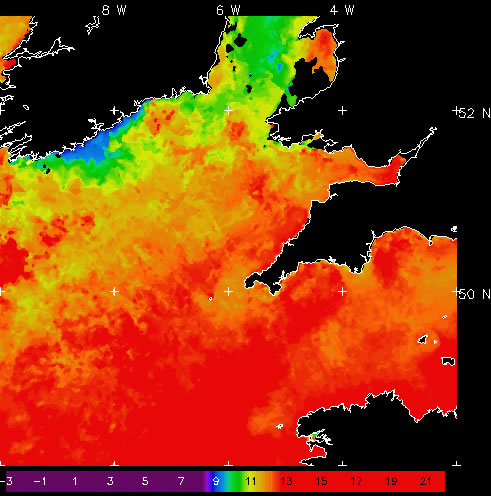
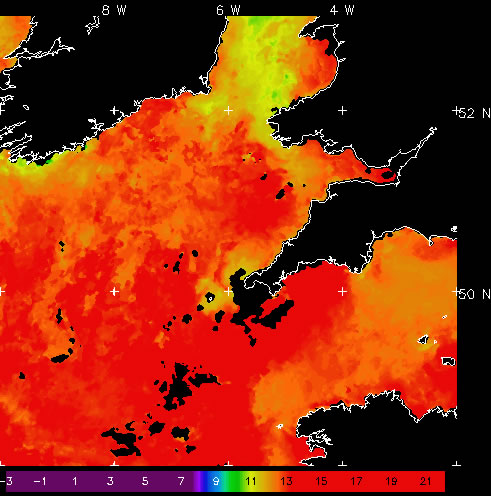
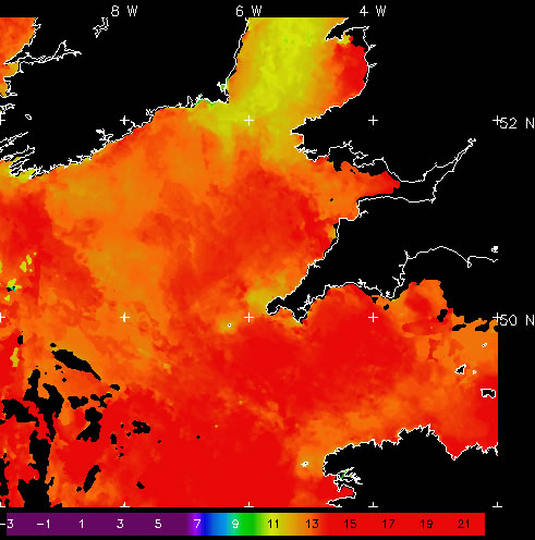
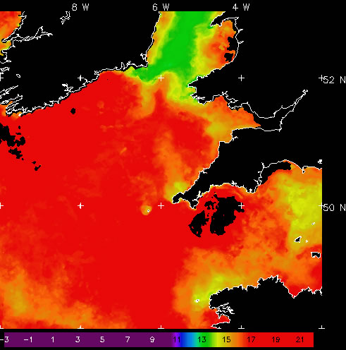
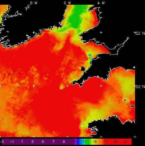
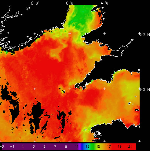
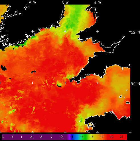
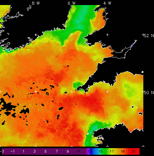
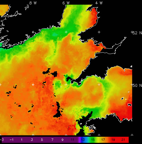
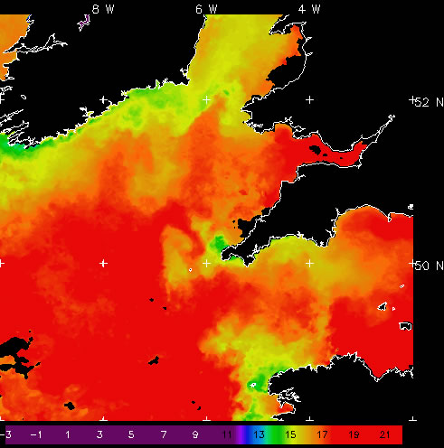
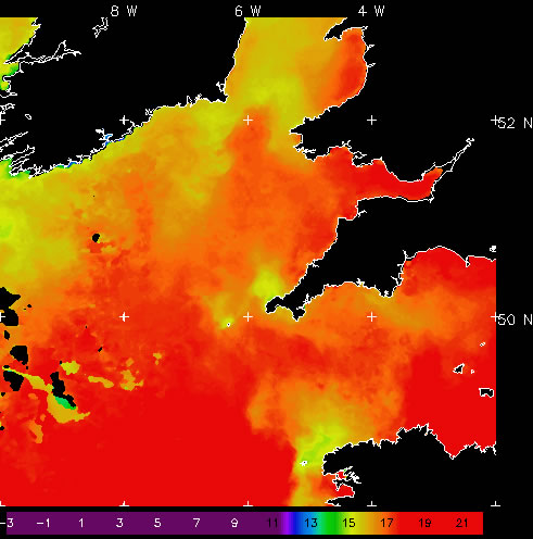
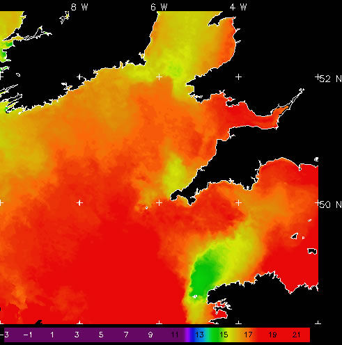
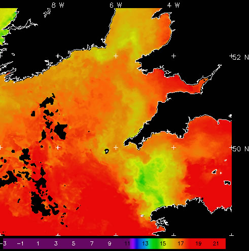
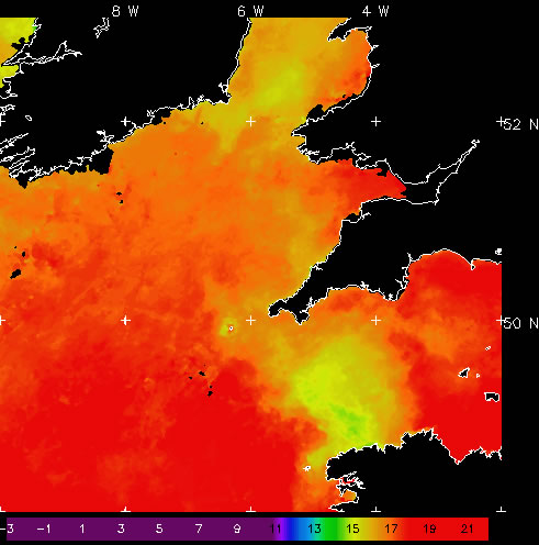
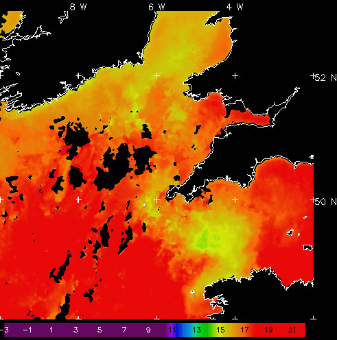
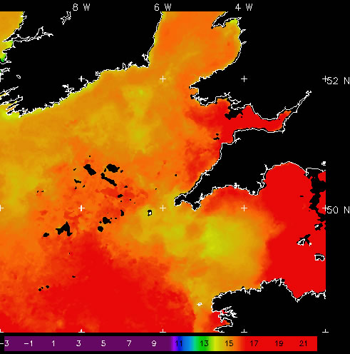
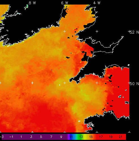
AVHRR sea surface temperature 7 day
Sea surface temperature (SST) data are used to observe physical phenomena such as currents, fronts, and eddies, and SST is an important factor controlling biological activity or influencing animal behaviour. SST data are produced by NEODAAS from the AVHRR series at ~1 km resolution (at nadir). All satellite imagery are copyright of the Natural Environment Research Council Earth Observation Data Acquisition and Analysis Service (NEODAAS). These images are near-real time composites and higher quality data are available directly from NEODAAS. NEODAAS must be acknowledged if these images are used in publications or presentations.
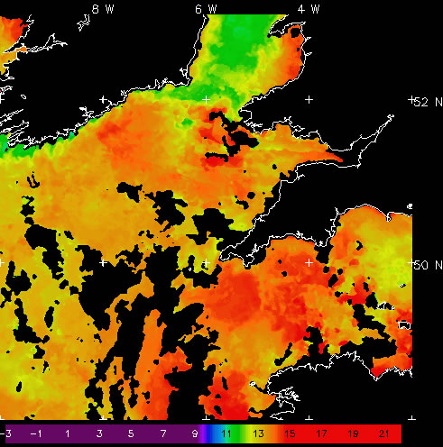
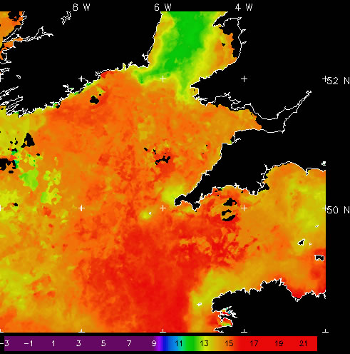


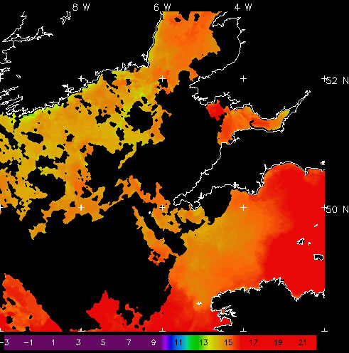
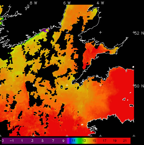
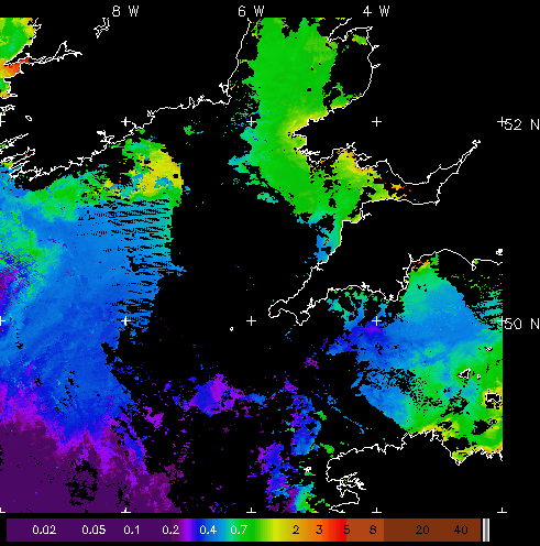
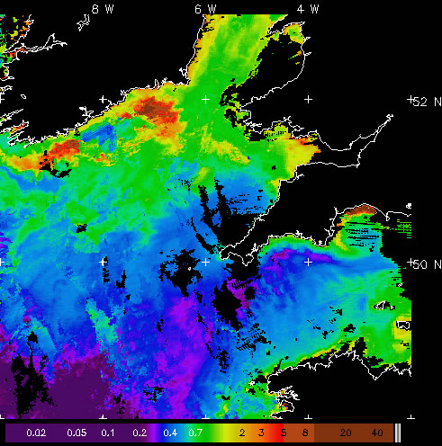
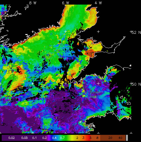
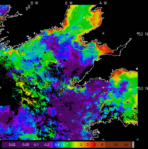
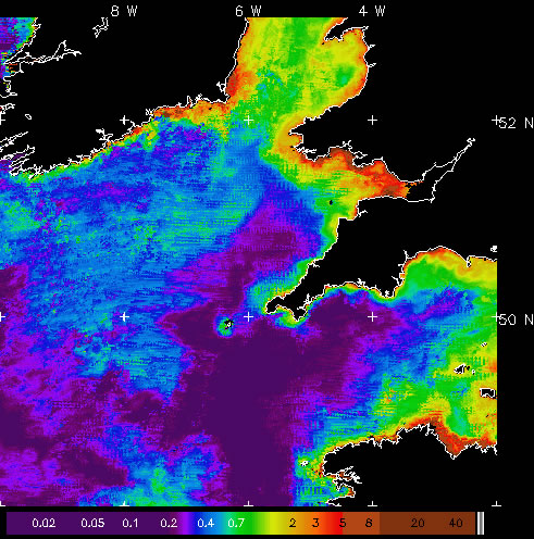
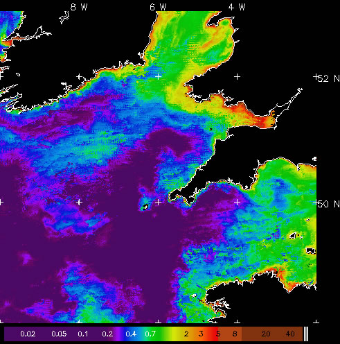
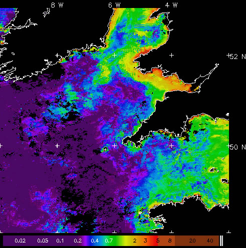
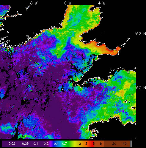
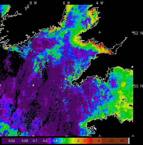
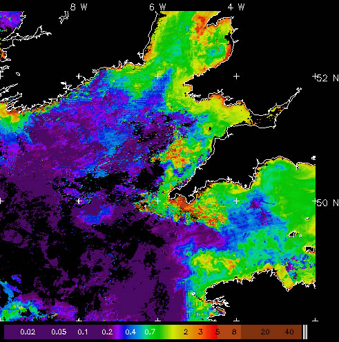
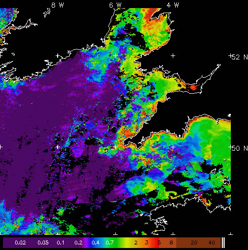
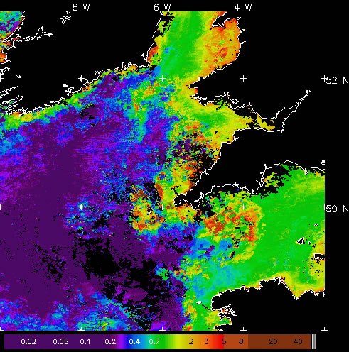
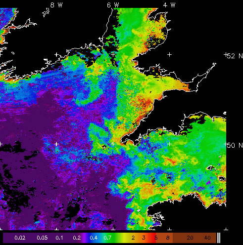
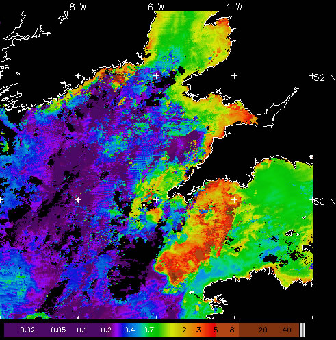
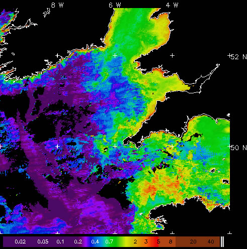
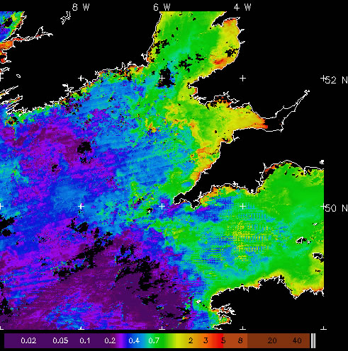
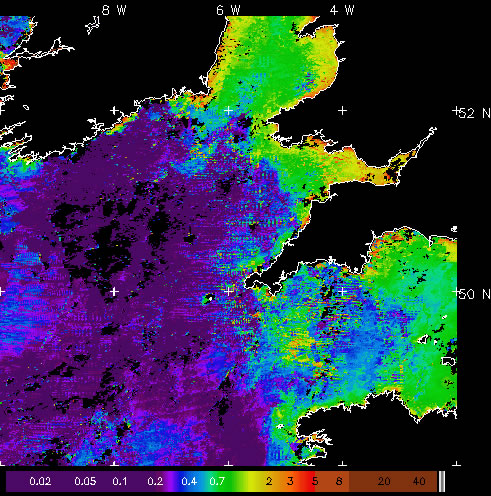
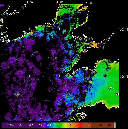
MODIS chlorophyll OC5 7 day
In-water chlorophyll-a concentration calculated using the OC5 algorithm from Aqua-MODIS. MODIS resolution is approximately 1 km at nadir. All satellite imagery are copyright of the Natural Environment Research Council Earth Observation Data Acquisition and Analysis Service (NEODAAS). These images are near-real time composites and higher quality data are available directly from NEODAAS. NEODAAS must be acknowledged if these images are used in publications or presentations.